
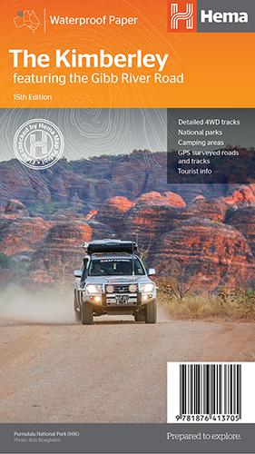
Hema The Kimberley Map
$15.95
Save $17.85 with the Kimberley 4WD Pack!
A regional map of the Kimberley that features the iconic Gibb River Road. On the reverse are inset maps for Purnululu National Park, the Dampier Peninsula and the Parry Creek area. There is also extensive drive detail and trip coverage for the Gibb River Road.
- Waterproof paper
- Detailed 4WD tracks
- National parks
- Camping areas
- GPS surveyed roads & tracks
This new edition of Hema’s best-selling Kimberley map features our latest mapping and points of interest in a stunning new cartographic style. It combines Hema’s entire database of remote roads and 4WD tracks with touring points of interest and topographic information.
This waterproof regional map of the Kimberley features the Gibb River Road. On the reverse are inset maps for Purnululu National Park, the Dampier Peninsula and the Parry Creek area. Detailed trip coverage and drive detail for the Gibb River Road is featured as well, with inset mapping covering the journey and corresponding text to guide explorers.
Also included is national park information and relevant contact details for pre-trip planning and use on the road or track.
Related Items
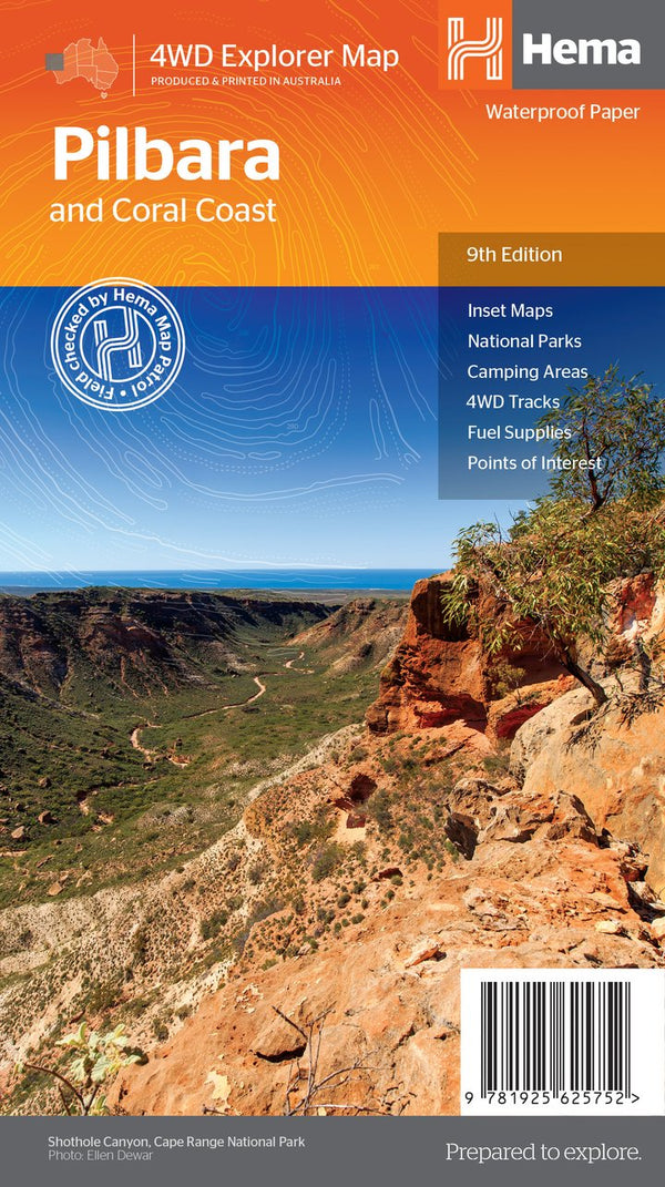

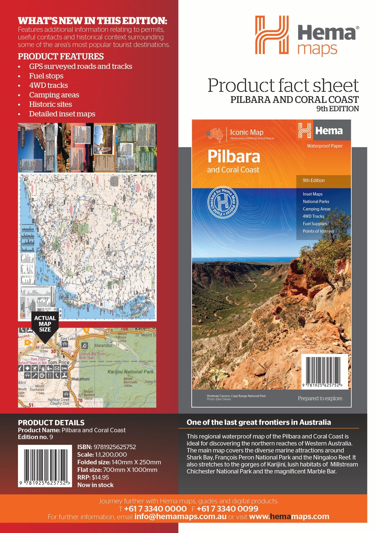
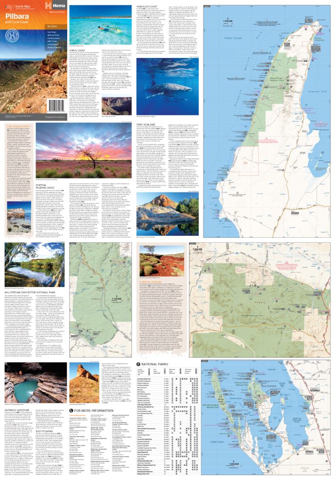
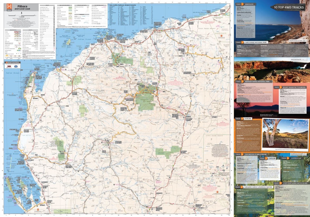
Hema Pilbara & Coral Coast Map
Not available at this time or sold in-store only.
A regional map of the Pilbara and the Coral Coast (1:1,250,000), with inset maps and comprehensive travel information on specific regions on the opposite side. The inset...
View full product details
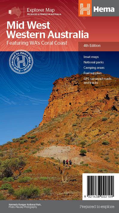
Hema Mid West Western Australia Map
$15.95
Hema Mid West Western Australia Map Mapping of Mid West Western Australia (WA) that has camping areas, national parks, fuel supplies and facility symbols marked on...
View full product details

Hema Western Australia State Map
$15.95
A map of Western Australia (WA) for touring throughout the state that has camping and rest areas, 24-hour fuel and points of interest marked on the mapping. On...
View full product details