
Bibbulmun Track Maps
$12.95
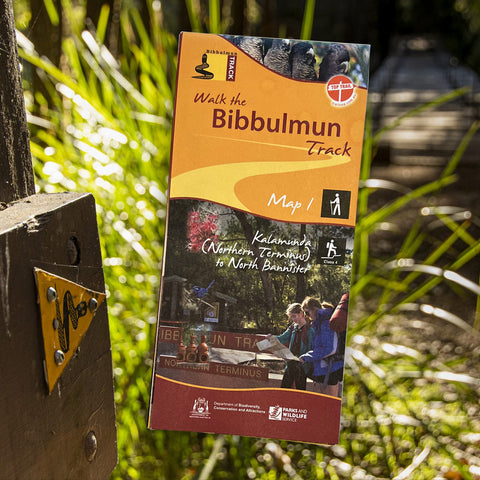
Map 1 - The Darling Range
This map extends from Kalamunda (Northern Terminus) to North Bannister
Map 2 - Dwellingup
This map extends from North Bannister to the Harvey-Quindanning Rd
Map 3 - Collie
This map extends from the Harvey-Quindanning Rd to Mumballup
Map 4 - Blackwood
This map extends from Mumballup to Brockman Highway.
Map 5 - Pemberton
This map extends from Brockman Highway to Middleton Rd.
Map 6 - Northcliffe
This map extends from Middleton Rd to Woolbales Campsite.
Map 7 - Walpole
This map extends from Woolbales campsite to William Bay campsite.
Map 8 - Denmark/Albany
This map extends from William Bay campsite to Albany (Southern Terminus).
Related Items


Black Diamond Trail Vista FLZ Trekking Poles - Pair
$259.99
Combining the packability of a Z-Pole with Flicklock adjustability, the Trail Vista FLZ is an excellent choice for short hikes, steep scrambles and long hikes....
View full product details


Black Diamond Trail Vista Shock Trekking Poles - Pair
$259.99
Packed with comfort-focused features like ergonomic cork grips and foam grip extensions, plus our uniquely designed, streamlined shock, the Trail Vista Shock provides max cushioning...
View full product details

Black Diamond Trekking Poles Pair - Trail Explorer 3
Not available at this time or sold in-store only.
Built for the comfort-conscious hiker, the Explore 3 Trekking Pole offers reliable stability and support for day hikes and backpacking adventures. This packable three-section pole...
View full product details