
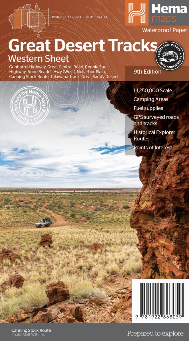
Hema Great Desert Tracks Western Sheet 9th Edition
$15.95
Hema's Great Desert Tracks maps are essential for anyone travelling in the Australian outback. The mapping features roads and 4WD tracks field-checked by the Hema Map Patrol, Points of Interest for remote area travellers and touring information for learning more about the region and planning your journey.
The Great Desert Tracks Western Sheet covers from beyond Derby in the north to Norseman in the south, and from Halls Creek in the east to Marble Bar in the west. Marked on the mapping are roads and 4WD tracks checked by the Hema Map Patrol, distance markers, topographical relief and touring points of interest including 24-hour fuel, camping areas and caravan parks, facilities, services and more. Also included is information on travelling in the desert, what you need for the trip and relevant contact information.
Key tracks include:
- Gunbarrel Highway
- Great Central Road
- Connie Sue Highway
- Anne Beadell Highway (West)
- Nullabor Plain
- Canning Stock Route
- Talawana Track
- Great Sandy Desert
Key Features
- All maps field checked by the Hema Map Patrol
- Printed on durable, waterproof paper
- Camping areas
- Fuel supplies
- GPS surveyed roads and tracks
- Historical explorer routes
- Points of Interest
Key Specifications
Edition: 9th
Publication Date: 15/06/22
Scale: 1:1,250,000
Folded size (WxHxD): 140mm x 250mm x 6mm
Flat size (WxH): 700mm x 1000mm
Weight: 0.055kgs
Related Items
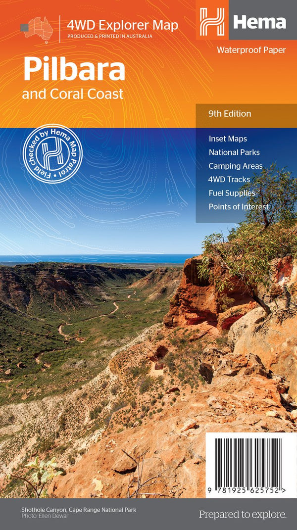

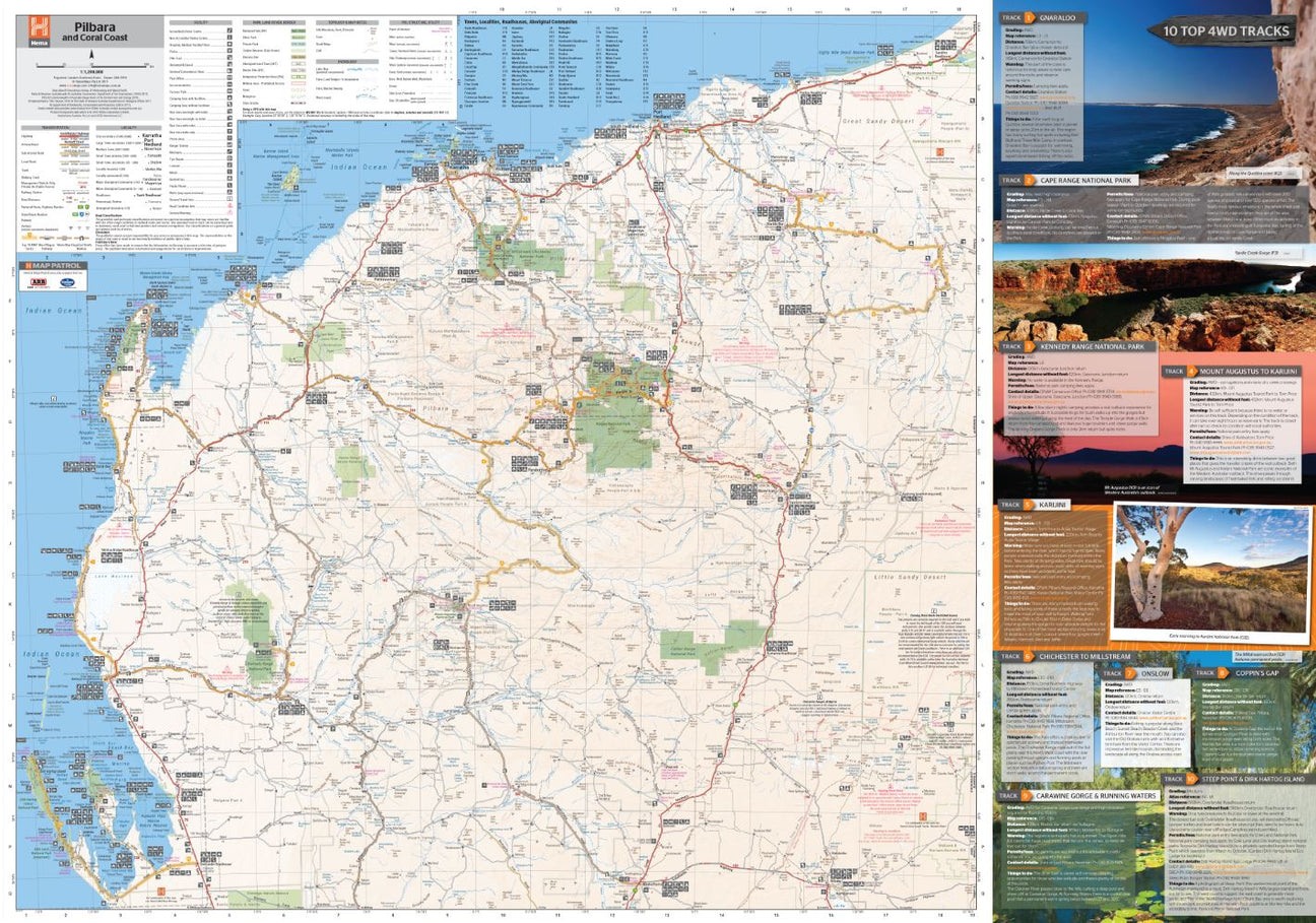
Hema Pilbara & Coral Coast Map
Not available at this time or sold in-store only.
A regional map of the Pilbara and the Coral Coast (1:1,250,000), with inset maps and comprehensive travel information on specific regions on the opposite side. The inset...
View full product details
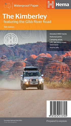
Hema The Kimberley Map
$15.95
Save $17.85 with the Kimberley 4WD Pack! A regional map of the Kimberley that features the iconic Gibb River Road. On the reverse are inset maps...
View full product details
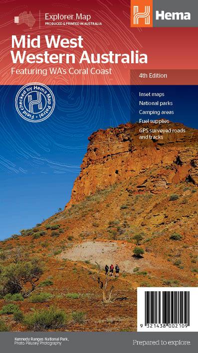
Hema Mid West Western Australia Map
$15.95
Hema Mid West Western Australia Map Mapping of Mid West Western Australia (WA) that has camping areas, national parks, fuel supplies and facility symbols marked on...
View full product details