


Hema Australia Road & 4WD Atlas (Spiral Bound) - 252 x 345mm
$44.95
Hema Australia Road & 4WD Atlas (Spiral Bound) - 252 x 345mm
Featuring trusted Hema mapping for all of Australia, the Hema Road & 4WD Atlas is the definitive travel guide for tourers and adventurers. Hema atlases feature more information useful to travellers, including 4WD tracks, campsites, caravan parks, rest areas, 24-hour fuel and points of interest.
The new edition contains more mapping than ever before, which is enhanced by a striking new cartographic style that’s incredibly easy to read. Included in this is up-to-date mapping for Australia’s biggest 4WD destinations: Cape York, Fraser Island, the Top End, the Kimberley, the Pilbara, Central Australia, High Country Victoria and the Flinders Ranges.
A handy distance grid, national park guide, list of accredited information centres and a complete index are also included to assist with trip planning and navigation, making it the perfect tool for guiding tourers, campers, road trippers and off-roaders throughout Australia.
What’s new in this edition:
- All new cartography
- Clear, easy-to-read style
- 188 new maps
- Featuring more detail for popular coastal areas
Product features:
- Detailed 4WD tracks
- Fuel
- Points of interest
- National parks
- Campsites
- Caravan parks
- Rest areas
- Road distances
- Fully indexed
Related Items

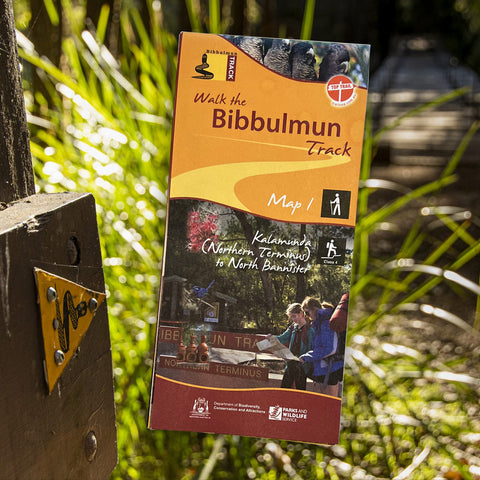
Bibbulmun Track Maps
$12.95
Map 1 - The Darling RangeThis map extends from Kalamunda (Northern Terminus) to North Bannister Map 2 - DwellingupThis map extends from North Bannister to...
View full product details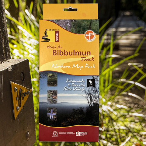


Bibbulmun Track Maps - Northern Map Pack 1-4
$39.95
Walk the Bibbulmun Track! This series of four maps covers the 502km northern section of the Bibbulmun Track between the Northern Terminus situated in Kalamunda...
View full product details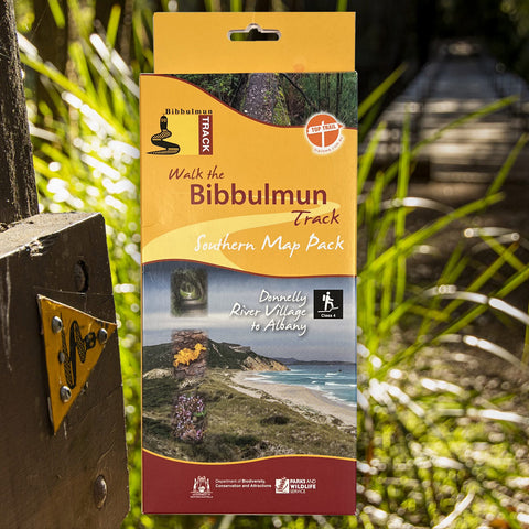


 - 252 x 345mm&media=https://www.campingoverlanding.com.au/cdn/shop/products/1._australia_rd_4wd_a_g_ed13__spiral_bound__cover_1296x_5aabcc9e-9a69-4e56-a7db-2957b90fc395_600x.jpg?v=1653014869)
Bibbulmun Track Maps - Southern Map Pack 5 - 8
$39.95
This award-winning, world-class 1060km walking track stretches from the Perth Hills to Albany and traverses the most beautiful natural areas of Australia's south-west. It provides...
View full product details